Designing Google Maps for Motorbikes
How getting your hands dirty during the research phase can lead to better, more inclusive products
When our Google Maps research team began traveling to India and Indonesia, we wanted to understand the changing needs of people living in rapidly growing global communities. We took a closer look at Delhi and Jakarta, two of the most populous cities in these countries, and quickly realized that Google Maps was falling short.
In Delhi, the time people spend in traffic has doubled in the last six years. In Jakarta, the average is 22 days a year. Due to these challenges, “two-wheelers,” or motorcycles and scooters, are an overwhelmingly popular way to get around. The ability to weave through traffic, and a cheaper price point (compared to cars), make two-wheelers particularly efficient. Our on-the-ground research made it clear that this mode of transport is a way of life in these cities. There was just one problem: Google Maps was designed for cars.
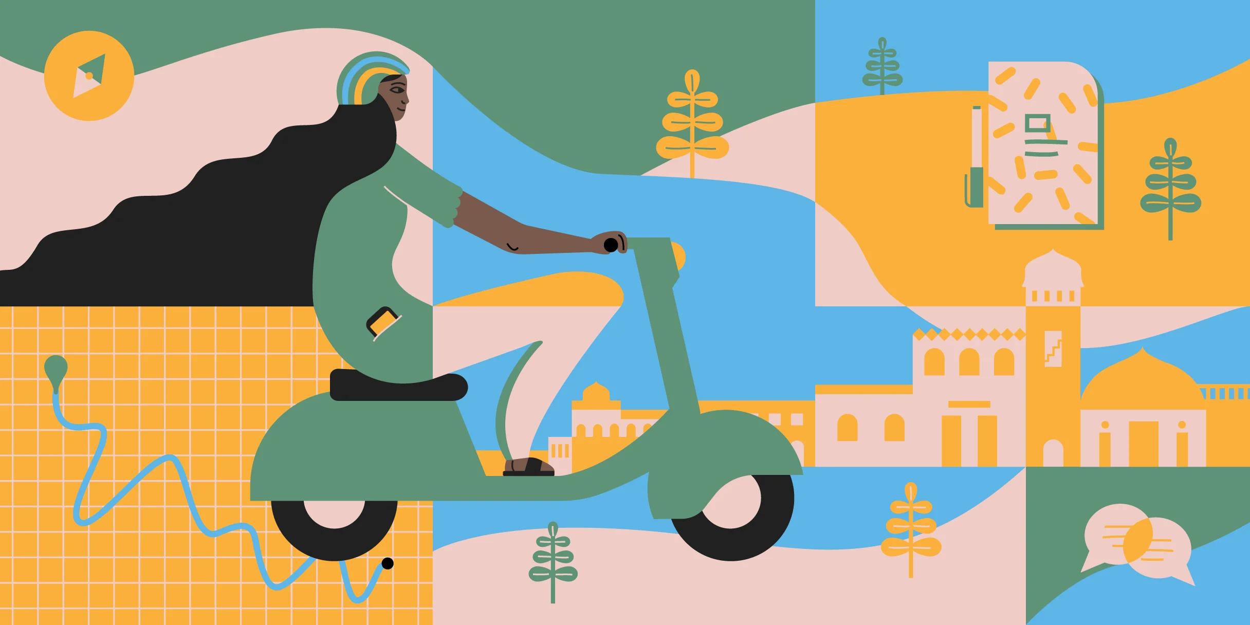
First, we had to adapt the product to the growing number of people who rely on two-wheelers. Spending time with drivers in the field helped us build the new two-wheeler mode for Google Maps—available on Android in India and Indonesia—which includes improved voice navigation, custom routes, shortcuts, and more landmarks for better orientation while traveling by two wheels instead of four. Though this specific set of features may not directly apply to your product, immersive research tactics bring value to any design process and lead to better products. Here, Google researcher Raj Arjan and designer Lauren Celenza outline their biggest takeaways for helping product teams find new opportunities to connect with the people they’re building for.

Two-wheeler mode shows which routes are accessible to motorbikes. The feature includes shortcuts for faster arrival times (note the different routes for cars and bikes in the example above), landmarks for stronger orientation, and additional languages for inclusive voice navigation.
Engage with your local audience
To rethink how Google Maps could work for two-wheeler drivers, we needed to change the way we thought about the problem at hand. Instead of relying on a straightforward problem-solution mindset, we focused on in-person research to help us to better understand and relate to people’s daily experiences and needs. That shift required a change in process: We needed to go to where the two-wheeler drivers were, and we needed to bring a diverse team with us.
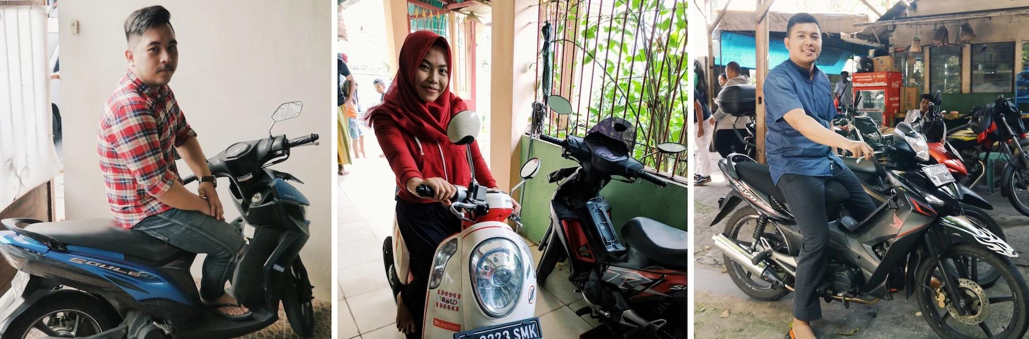
Two-wheeler drivers in Jakarta show us their diverse bike styles.
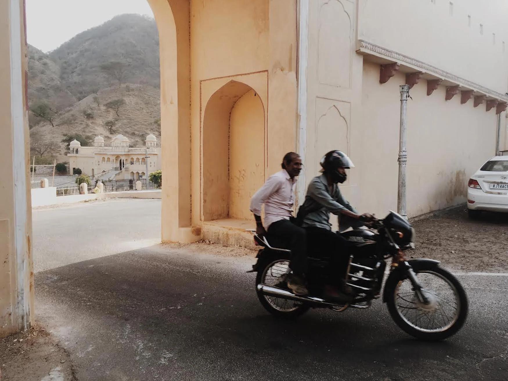
The research team included engineers, UX designers, product managers, and marketing leads, all from different parts of the world. We met with two-wheeler drivers from Jaipur, Delhi, Bangalore, and Jakarta, in environments from bustling transportation hubs to kitchen tables in people’s homes. Our intention was to understand and relate to people in a way that felt authentic—we wanted to learn through immersion. (To learn more about organizing a trip to the field with your team, take a look at our in-depth article on immersion trips.)
During our trip, we had conversations with two-wheeler drivers and rode bikes with them throughout the city. This immersive research process helped us better understand the way two-wheeler drivers made decisions on the road. We found that people used a variety of methods to navigate on their two-wheeler, some memorized the route beforehand; others followed voice navigation. Many listened to the passenger riding with them or connected their phone to the speedometer, using a suction mechanism on the back of the phone.
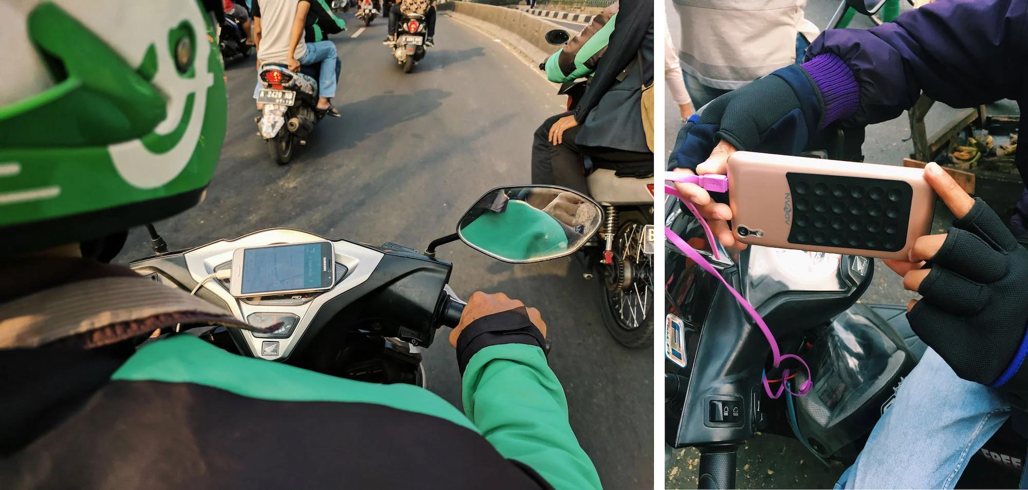
Two-wheeler drivers in Jakarta demonstrate how they connect their phones to their bikes, either with a phone holder (left) or with a suction device (right).
These conversations also helped the research team see which features would be most helpful to drivers. It was clear that shortcuts and landmarks helped drivers navigate the city faster and more safely. At the time, Google Maps didn’t offer specific routes or arrival times for bikes and mopeds or two-wheeled transportation, which resulted in inaccurate experiences. Seeing these issues first-hand helped us understand the tremendous opportunity for improvement and inspired us to go one step deeper in our learning process.
Team up with local communities
To truly understand how these issues affected drivers on a daily basis, we set out to work more closely with the people who spent the majority of their workday on a two-wheeler. While in Jakarta, we created a workshop with a group of drivers from Go-Jek, a motorcycle ride-hailing service that operates in 50 cities across Indonesia.
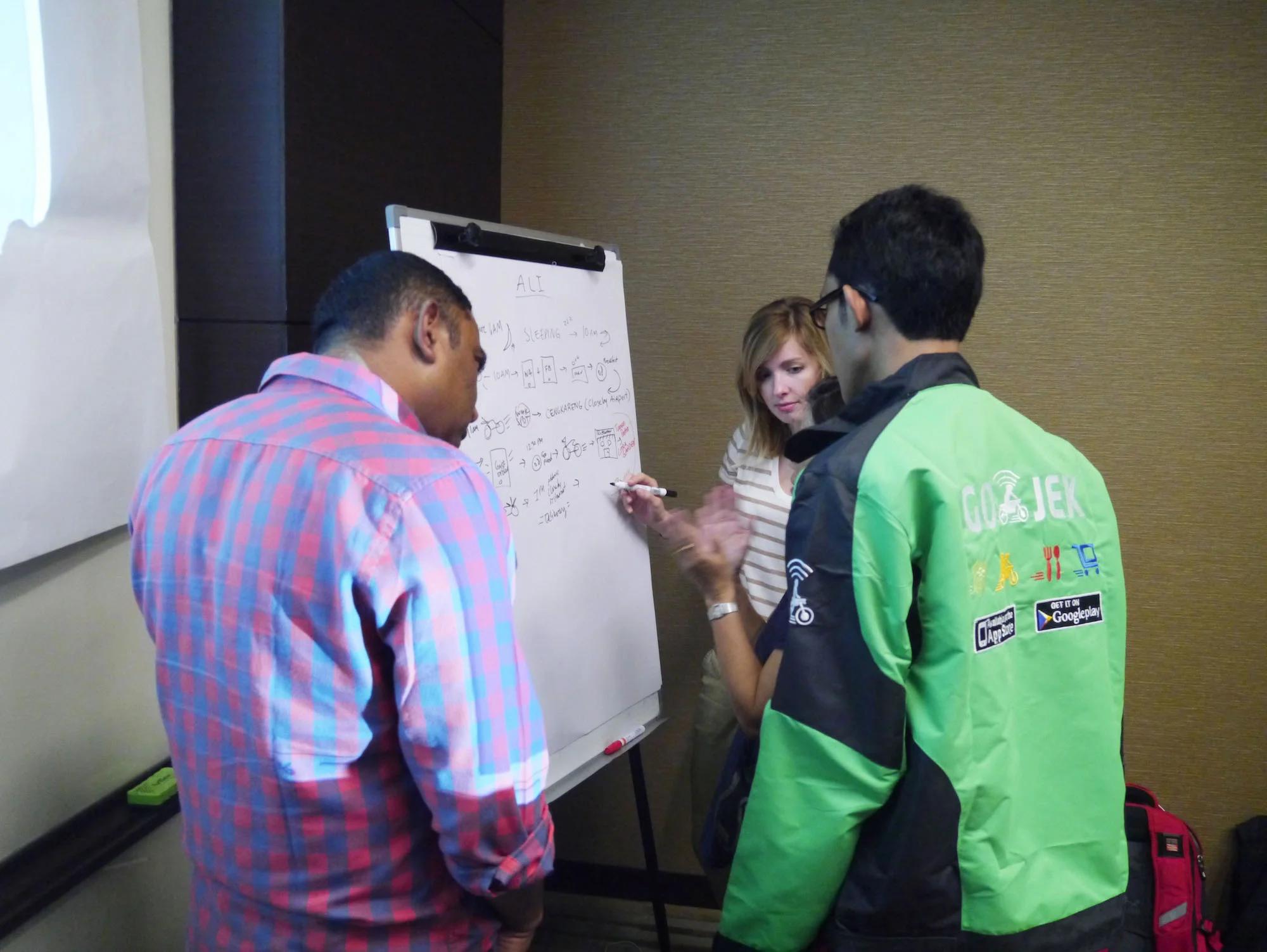
A Go-Jek driver describes a timeline of his day with Google designer Lauren Celenza and Group Product Manager Krish Vitaldevara.
We learned about drivers’ deep knowledge of their city, daily needs, and community values. We drew timelines of what drivers did on a typical day, discussed the “pros and cons” of living in Jakarta, and sketched ideas together. These activities helped us prioritize the needs that mattered most. For example, several drivers told us that Google Maps often suggested roads that were inaccessible to two-wheeler vehicles, which led to frustration.
Another key takeaway from this workshop was understanding how Go-Jek drivers interacted as a community. The drivers described how they relied on each other if they got lost or when their devices weren’t working well, demonstrating how people make decisions as a community, not just as individuals.
After the immersion trip, we continued to partner remotely with more drivers throughout our product development process. Our partners in India and Indonesia helped us test routing quality, arrival times, landmark quality, and navigation. This testing process also helped us quickly identify roads that were not suited for two-wheelers, as well as additional landmarks that were missing from the map. Whatever the product, collaborating with people in local communities throughout the product cycle is critical to ensure a more responsible, inclusive process.
Share insights through storytelling, not just data
Immersion in local communities helped the field research team relate to and empathize with our audience, but another challenge was still ahead of us. We needed to bring this deep level of understanding to our teammates who were not involved in the process and lived thousands of miles away.
In traditional research reports, learnings are often communicated through data. But numbers only reveal one part of the story and neglect the emotional, social, and environmental moments that make us human. Building thoughtful experiences requires a more nuanced understanding of people, which is why we decided early in the research process to record our experiences through video, photo, and audio. We wanted to create a deep understanding that could be felt, not just known. This sensory, multimedia approach helped our teammates back home respond to our findings on an emotional level.
During our field research, we captured 360º videos, sounds, photographs, and personal stories to express the feeling of riding a two-wheeler in a congested environment. When we completed our field research, we collected these artifacts and created an immersive story to recreate the feeling of actually being in the field. These storytelling elements may take time and resources to produce, but they promote empathy, advocacy, and alignment across multiple teams and time zones.
Define design principles early to establish product vision and direction
Our immersive story included a set of design principles we wrote with our team as we analyzed insights in the field. These principles served as a foundation for cross-discipline teamwork and helped us focus on the most impactful improvements we could make. Some of these principles and improvements even resulted in making the Google Maps experience better for everyone living in India and Indonesia–not just two-wheeler drivers.
The design principles also helped us work out specific details. For example, Google writer Christine Nguyen referred to the guide when choosing a name for the mode. To relate more closely to the local dialect, ‘two-wheeler’ was chosen for audiences in India, and ‘motor’ for Indonesia.
‘Empathy’ is more than a concept, it’s a practice that all disciplines share throughout the process
Immersion in local communities helped our field research team relate to our audiences.
Developing the two-wheeler mode for Google Maps was the first time in years that we added a new transportation feature to our app. Designing empathetic experiences with product teams and working with local communities was critical for ensuring a more inclusive experience for two-wheeler drivers.
Reading a research report or going to a conference will never offer the same value as riding on the back of a two-wheeler for 45 minutes, lost because Google Maps didn’t work for you. Building strong connection and resonance requires going beyond designing the product; it’s also about designing the practice of empathy and culture as a core part of the product development process.